This is Lughayangu - the weekly newsletter where I share stories on African culture, history and languages.
You can call me your favourite “grandy” - I share the best African stories that your grandpa doesn't know.
Did I mention Lughayangu is now the largest African dictionary South of the Sahara and north of Limpopo? - a subliminal flex 🙂
Now you know where to look for the meaning of that charming word your favourite African brother has been using.
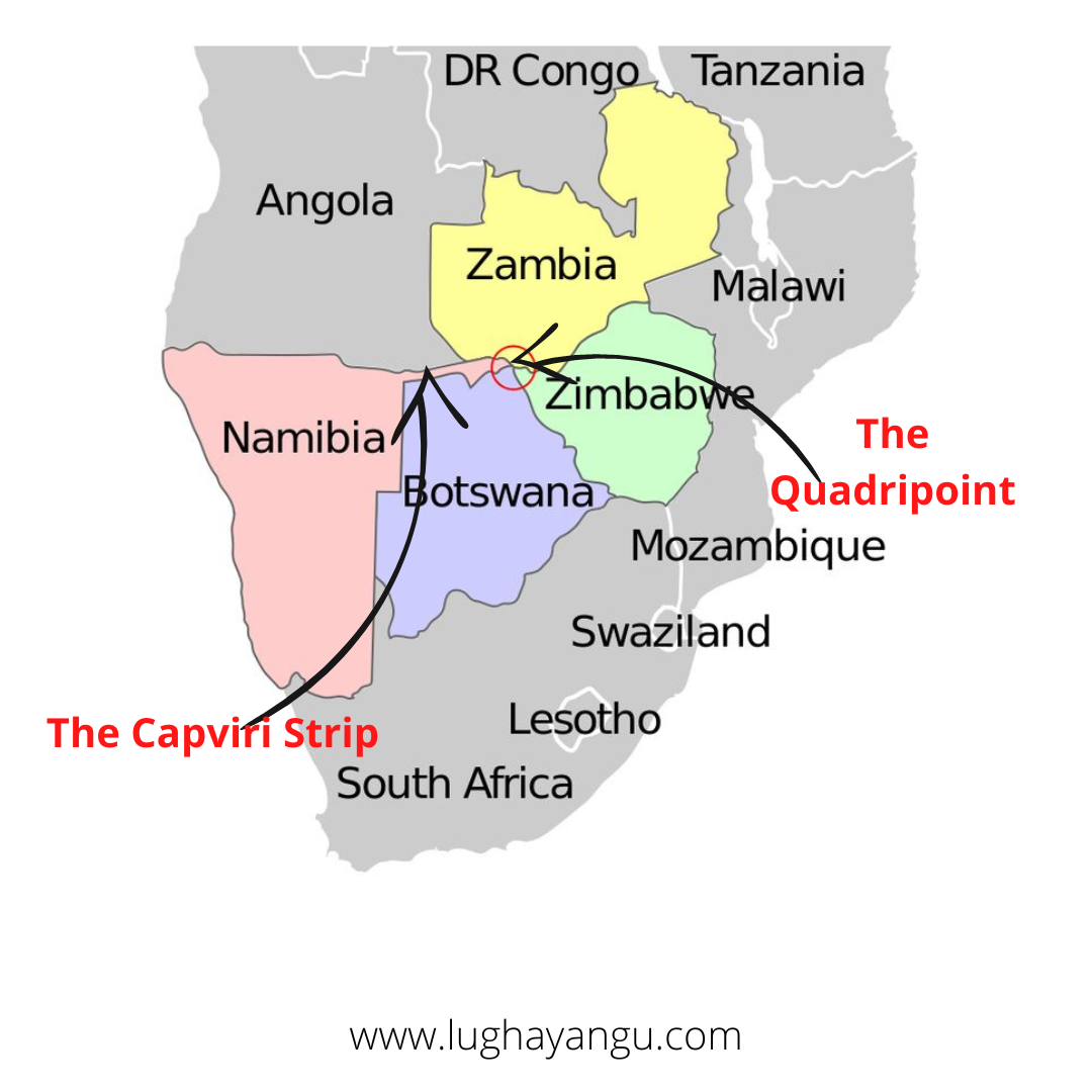
This week, Keith shares the story of how the Land of the Brave: Namibia, gained its Caprivi Strip border, a quadripoint and the only place on earth where four countries meet.
Caprivi Strip border
Before the construction of the Suez Canal in 1856, anyone intending to travel to the Eastern side of Africa from Europe by ship had to sail through the west and then the south to finally get to the East. More often than not, the sailors would anchor in the nearby towns to re-stock their supply.
In the year 1828, the Protestant Church in Germany formed a missionary group known as the Rheinische Missionsgesellschaft (Rhenish Missionary Society), and their first missionaries were sent to the Southern part of Africa. The missionaries, led by Franz Heinrich Kleinschmidt and Carl Hugo Hahn, landed in an area on the Coast, where they started building churches in the territory.
Settled here, they started making inroads into the territory slowly. Since the local communities such as the Herero and the Namaqua would regularly be at war with each other, the missionaries would regularly step in and arbitrate the matter. Therefore, the locals started trusting them.
This was the colonial’s system in play, since, when German merchant Adolf Luderitz arrived in 1882, the locals willingly sold their land to him, in exchange for some coins and guns. Luderitz, thanks to blessings from Otto von Bismarck, went on to place the area under the protection of the Imperial German Empire, thus it became known as the German South West Africa (now Namibia).
On the other side of the continent, Karl Peters had also acquired a huge chunk of land in East Africa for the German Empire, deeming it the German East Africa (now Tanzania). Now, the challenge came about as any settler or administrator who wanted to travel from one colony to the other, would have to sail round the south of the continent. That was a very long distance, and so, the administrators started brainstorming on a way to make this possible.
The land which separated their two colonies was owned by the British. Therefore, the only way they could see through their aspirations was to enter into concessions with the British. They couldn’t, of course, be granted the whole land, therefore, they had to come up with a compromise. A couple of kilometres from the end of the Germany South West Africa’s border was the River Zambezi, which flowed all the way to the Indian Ocean. If the Germans could gain access to the River Zambezi, then they could sail with it to the Indian Ocean and finally sail up to the German East Africa.
Upon approaching the British, they agreed on a deal, which came to be known as the Heligoland-Zanzibar Treaty. Here are the benefits each group got:
Benefits to Germany
- A 400-km long strip of land extending from the northeastern border of Namibia to the River Zambezi.
- Free and unrivalled access to the German East Africa (Tanzania).
- Acquisition of the Heligoland islands in the North Sea.
Benefits to the British
- Acquisition of Wituland – a territory on the coast of British East Africa (Kenya) now in the region of Lamu.
- Free and unrivalled access to the island of Zanzibar.
With this in mind, the Germans started the voyage along the Zambezi River, only to discover that it is not navigable to the end, after encountering the majestic Victoria Falls. Therefore, they were stuck with the Caprivi Strip.
Germany, feeling short-changed, tried to re-negotiate the Caprivi strip with another favourable territory, but no agreement was reached. After losing the First World War, however, Germany was forced to give up the German South West Africa territory to the British settlers in South Africa (Union of South Africa), and it became known as South West Africa.
It remained under British rule until 21st March 1990, when the Africans finally gained self-rule. Even then, the Namibians still retained with the Caprivi Strip. An interesting fact about it is that four countries meet at the tip of the strip; that is Namibia, Zambia, Botswana and Zimbabwe.
Language Learning
Resources:
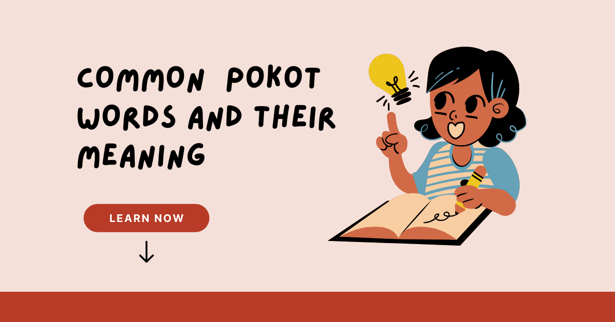
✅ Common Pokot Phrases and their meaning
Language of the Week:
Wolof - spoken in Gambia, Mauritania and Senegal and has approximately 12,500,000 native speakers.
PS: I have been receiving requests from people asking me to teach them an "African" language.
I am sorry to disappoint but I am no language tutor. The best I can do is help you say Love in Dholuo, Gikuyu, Swahili or Sheng.
And even if I were, it would be next to impossible to teach all of the over 2000 languages spoken in Africa.
The best I can do is to share tips and resources that you can use to learn these languages. Most of these resources are freely available on the platform, and you can access them by navigating to your favourite language.
PSS: That said, if you are eagerly looking for a language tutor for any African language or on the flip side, you are an excellent tutor and looking for students, reach out and I would gladly connect the circuit.
Join the Lughayangu Community!